 vesseltracker.com
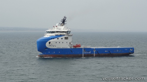
Vessel 'NAO GALAXY' IMO: 9748344, MMSI: 258159000
UTC, 31.52447, 30.10105, course: 282, speed: 0.5
UTC, 31.51831, 30.08945, course: 100, speed: 0.2
2026-02-06 14:15:43 UTC, 31.51766, 30.08892, course: 95, speed: 0.1
Live AIS position:
UTC. 12 nm N of ABU QIR),
updated 2026-02-06 14:15:43 UTC.
Find the position of the vessel 'NAO GALAXY' on the map. The latter are known coordinates and path.
marine traffic ship tracker show on live map
The current position of vessel 'NAO GALAXY' is 31.51766 lat / 30.08892 lng. Updated: 2026-02-06 14:15:43 UTCDetails:
Last coordinates of the vessel:
UTC, 31.52601, 30.09986, course: 230, speed: 0.1UTC, 31.52447, 30.10105, course: 282, speed: 0.5
UTC, 31.51831, 30.08945, course: 100, speed: 0.2
2026-02-06 14:15:43 UTC, 31.51766, 30.08892, course: 95, speed: 0.1